


MapServe®
United Kingdom
MapServe® offers professional mapping and geospatial information of the UK to a range of land and property experts.
Main Services:
Ordnance Survey Mapping, OS MasterMap\u00ae, Contours, CAD Mapping, Location Plans, Block Plans, DWG Maps, DXF Maps, Old Maps, Topographic Maps
This includes 1000’s of architects, surveyors, telecoms consultants, developers, arboriculturists, energy companies and many others.
We started back in 2012 and have since become the highest rated site of its type, with a 4.8 out of 5 rating on review.io (as of Oct ’22). To achieve this, we’ve been obsessive about the customer experience and constantly improve the website to ensure the map buying experience is the best in class. As a consequence, our customers stay with us for a long time.
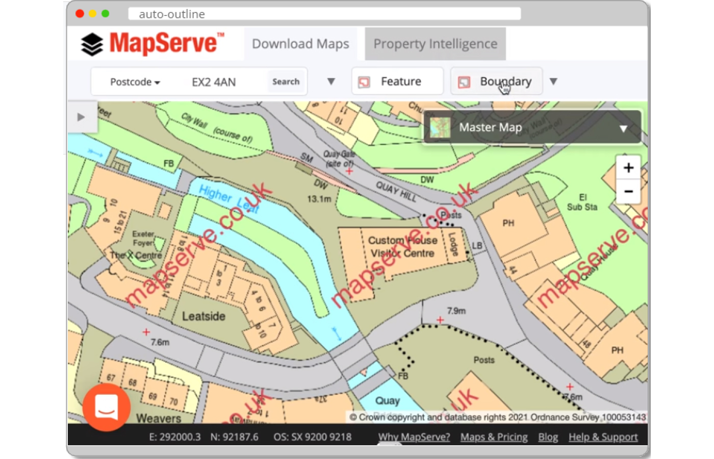
In terms of the mapping we offer, this includes OS MasterMap® as a topographic layer, featuring a highly detailed record of the natural and built environment. It is a database that records every fixed feature of the United Kingdom that is greater than a few metres in a single continuous digital map that gets updated every 6 weeks. Buildings, roads, tracks, walkways, railroads, rivers, lakes, ponds, constructions and land parcels are examples of OS MasterMap® topographic features. Non-topographic information such as administrative and electoral boundaries, cartographic text and symbols, and postal addresses are also included in the data.
To complement OS MasterMap® we have available a number of optional datasets including 1m contours, building heights, a tree map and freehold boundaries. These are all available in CAD formats like DWG and DXF, and PDF / PNG covering Great Britain. MasterMap® is available in a simple 13 layer option as a summarised option or up to 67 layers for ultimate control of the data with free previews within a fair use limit, which helps our customers get the right area without racking up additional charges.
OS MasterMap® is also available in 3D format for CAD software that can help our users create building models for viewshed analysis, analysis of viewing corridors and massing studies.
In addition, we offer historic mapping that help provide historical overviews of your site dating back to the 19th century as well as aerial photography, a property report that contains important information about a site and other large scale topographic maps provided by the Ordnance Survey.
Our mapping can be used in various use cases, such as to find out a site’s location, for planning applications, building control & feasibility studies documents.
We are working hard to offer a simple and intuitive ordering process where you don’t need expensive and time-consuming training in order to access the latest, most up to date and accurate mapping in the UK. Our wide choice of maps and datasets support the design and planning process of all organisations in the industry. We are always dedicated to educating our team members on new mapping and geospatial data relevant to the building industry and stay up to date with the latest news. Our customers benefit from a UK cased customer support and marketing team that is always ready to help with their account management and requests. Our relationship with our customers is based on transparency and trust.
We’re also a proud OS Partner and an official RIBA CPD provider. The goal of our CPD seminar is to understand how mapping can help architects along each stage of the RIBA plan of works. Our broad range of creative mapping and geospatial products are tailored and cater to our clients’ needs for GIS data.